
AnserGIS consulting specialises in geo-spatial analysis, modelling and software development and can bring over 40 years of combined experience in research and consultancy to find the answers to your questions.
Add Spatial Data Science to your Research :
We can help you frame your questions to best effect and ensure you are well informed about the various options and issues before work begins. Learn More
Analytics & Software Development :
Pragmatic solutions, efficient methodologies, robust implementations. Results delivered in a concise, jargon free, and timely manner. Learn More.
Recent Highlights :
Learning To Teach GIS at Distance
Each year Åsa and I run the “Advanced Digital Landscape Analysis with GIS” Masters course at SLU. This year was a particular challenge as all teaching moved online due to Covid 19.
While we had been teaching a “flipped classroom” with lectures by video, discussions and practical work has always been supervised on campus. With a combination of Canvas course management software, Zoom supervision and two excellent Teaching Assistants (Christopher Klich and Johan Persson) the course was successful.
Since it is also the ADLA 10th Anniversary, we decided to celebrate our students achievements with an online exhibition of their work.
2020 Highlights
 New Book
It is a privilege of to be editor for : “Nature-based Solutions: Integrating Computational and Participatory Scenario Modelling for Environmental Management and Planning” Cambridge University Press https://lnkd.in/gPZRnPW
From the foreword by Professor Carl Steinitz :
“It examines issues involved in deciding how to plan for the profound, complex, uncertain and contentious changes which are expected to occur in the coming generations related to climate and demographic change. It focuses on human and scientific aspects related to the United Nations Development Goals, and especially on the key natural systems of soil, water and green infrastructure. In each of these, modelling methods applicable to planning vary, and there are choices related to an appropriate balance between scientific accuracy and public understanding which must be made – and these are not simple choices”
As a society we face hard choices, a book cannot make these choices any simpler, but I hope this book does help explain some of the modelling options we can use to better understand them.
The International Geodesign Collaboration
One of the hardest aspects of addressing these profound issues is how to ensure that the scientific knowledge which models can help translate, is taken up effectively within planning processes. Possible solutions are often contentious and require long term commitments, so achieving consensus is essential. That is why Neil responded enthusiastically when invited to join the International Geodesign Collaboration https://www.igc-geodesign.org/.
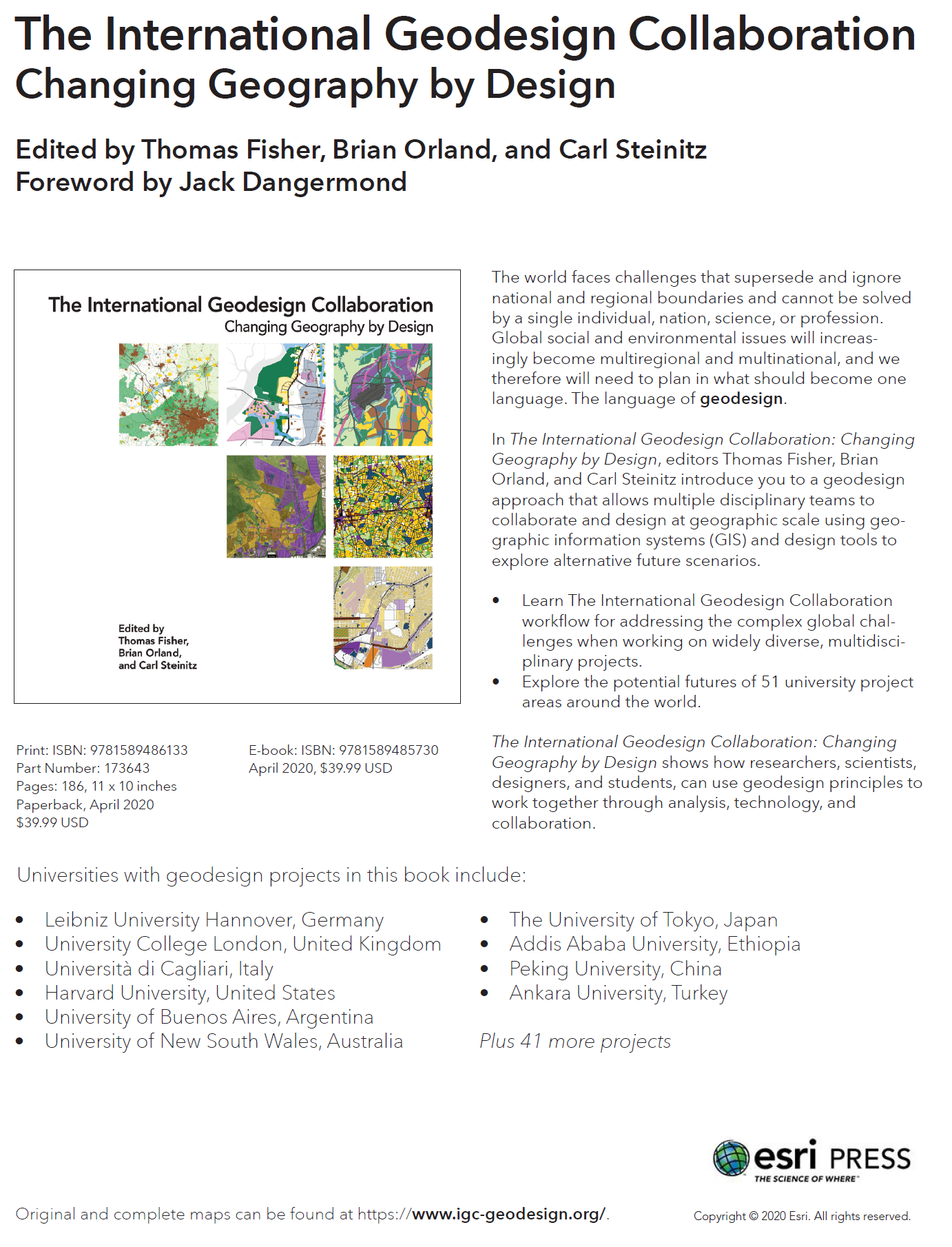
This book presents the results from the first year of that project. With case studies in Geodesign from over 50 universities worldwide which followed a coordinated approach and are presented in a standard format for easy comparison.
Geodesign focuses on how GIS and computer models can be effectively deployed with a planning process. This places an emphasis on intuitive tools which support discussion and collaboration.
As a small consultancy we can work flexibly and collaboratively with your team at all stages of a project. Please contact us with a brief description of your question, and we will be happy to discuss your requirements.
Qualifications and Experience / Software Competencies / Statistical Competencies / Previous Projects
We are an SME for EU Horizon 2020. If you are interested to include AnserGIS in an application please get in touch – we may even be able to access public grants to allow us to participate in its development.

A Micro-Enterprise